Map - Geoagiu (Oraş Geoagiu)
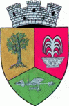
Geoagiu (Oraş Geoagiu)
Geoagiu (Algyógy, Gergesdorf) is a town in Hunedoara County, in the historical region of Transylvania, Romania, located on the Mureș River at an altitude of 217 metres above sea level. The river with the same name (Geoagiu) flows in this place into the Mureș. The town has a population of 5,049. It administers ten villages: Aurel Vlaicu (until 1925 Binținți; Bencenc), Băcâia (Bakonya), Bozeș (Bózes), Cigmău (Csigmó), Gelmar (Gyalmár), Geoagiu-Băi (Feredőgyógy), Homorod (Homoród), Mermezeu-Văleni (Nyírmező), Renghet (Renget) and Văleni (Valény).

The first settlements in the area can be found in the time of the Dacians, in the 1st century BC, as shown by archeological discoveries. After the Roman conquest, the Romans built the fort of Germisara in the 2nd century, however, it kept the original Dacian name. Germisara was defended by the Legio XIII Gemina.

The name of Germisara meant "hot water" (germi = "heat", sara = "waterfall") and it showed that the Dacians already knew of the thermal springs of the area. Another opinion that the name came from the Hungarian name of the Geoagiu River (Gyógy), which means "curative". But more probably, the name is coming from the Hungarian word dió (nut as fruit) with the suffix -d, so, after the first documentary citation, "villa Gyog" from 1291 appeared as Dyod és Dyog (1397), Aldyogh (1407), Algyogh (1412), Aldyod (1439), Alsodyod alio nomine Alsoffalwa (around 1444).

The first documentary citation of Geoagiu (it was written as "villa Gyog") was in the year 1291, when it was used as a land in the vicinity of Bintinti (now the village Aurel Vlaicu). At the 2011 census, 89.7% of inhabitants were Romanians, 8.81% Roma and 0.71% Hungarians.

There are remains of the old Roman way made of plate stones from Geoagiu to Geoagiu Băi. The city days are on August 14–17.

 
Map - Geoagiu (Oraş Geoagiu)
Map
Google - Map - Geoagiu
Google
Google Earth - Map - Geoagiu
Google Earth
Openstreetmap - Map - Geoagiu
Openstreetmap
Map - Geoagiu - Esri.WorldImagery
Esri.WorldImagery
Map - Geoagiu - Esri.WorldStreetMap
Esri.WorldStreetMap
Map - Geoagiu - OpenStreetMap.Mapnik
OpenStreetMap.Mapnik
Map - Geoagiu - OpenStreetMap.HOT
OpenStreetMap.HOT
Map - Geoagiu - OpenTopoMap
OpenTopoMap
Map - Geoagiu - CartoDB.Positron
CartoDB.Positron
Map - Geoagiu - CartoDB.Voyager
CartoDB.Voyager
Map - Geoagiu - OpenMapSurfer.Roads
OpenMapSurfer.Roads
Map - Geoagiu - Esri.WorldTopoMap
Esri.WorldTopoMap
Map - Geoagiu - Stamen.TonerLite
Stamen.TonerLite
Country - Romania
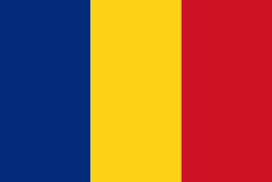
Flag of Romania
Romania (România ) is a country located at the crossroads of Central, Eastern, and Southeastern Europe. It borders Bulgaria to the south, Ukraine to the north, Hungary to the west, Serbia to the southwest, Moldova to the east, and the Black Sea to the southeast. It has a predominantly temperate-continental climate, and an area of 238397 km2, with a population of around 19 million. Romania is the twelfth-largest country in Europe and the sixth-most populous member state of the European Union. Its capital and largest city is Bucharest, followed by Iași, Cluj-Napoca, Timișoara, Constanța, Craiova, Brașov, and Galați. It is member of the European Union (EU), NATO, European Council, BSEC, and WTO.

Europe's second-longest river, the Danube, rises in Germany's Black Forest and flows southeasterly for 2857 km, before emptying into Romania's Danube Delta. The Carpathian Mountains cross Romania from the north to the southwest and include Moldoveanu Peak, at an altitude of 2544 m.
Currency / Language  
ISO Currency Symbol Significant figures
RON Romanian leu lei 2
Neighbourhood - Country  
  •  Bulgaria 
  •  Hungary 
  •  Moldova 
  •  Serbia 
  •  Ukraine 
Administrative Subdivision
City, Village,...